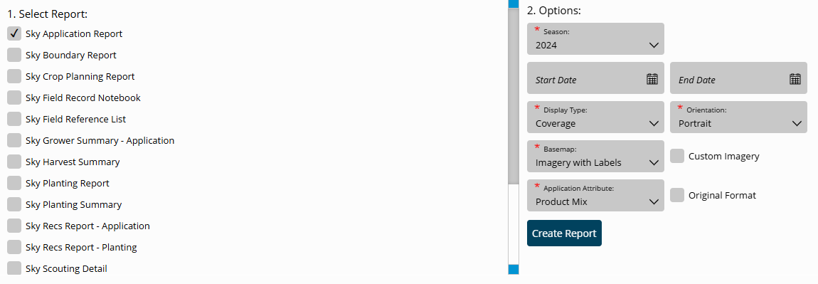
The Agvance SKY Application Report helps reconcile purchased product to applied product by displaying the actual product applied with minimum and maximum rates, along with visual comparisons for yield or soil test data.
- Navigate to Reports and select the option to run the SKY Application Report.
 Note: Individual Events under each Field can also be selected for this report. Selecting multiple Events for multiple Customers will cause the report to display per Grower.
 - Choose the appropriate season from the Season drop-down under Options. This runs all Application Events for the chosen Field(s) per season selected.
- Select the Display Type drop-down and choose from the following:
- Coverage – This displays results as a coverage type map.
- Point – This displays results based on point data.
- Polygon – Results display by polygon.
- Select the desired Basemap imagery from the Basemap drop-down menu.
- Once all desired report criteria is selected, choose Create Report.
- The report displays in the Reports Based on Field Selection grid with a status of In Progress. When the report has been generated, choose View Report to open the report.
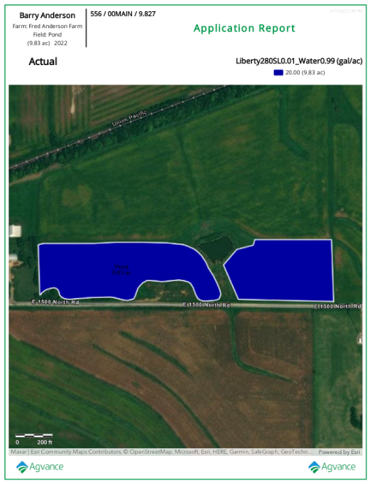 Note: With the report open, choose from multiple report tools on the left to Download, Print, or make additional markups/adjustments to the report.
 Note: Individual Events under each Field can also be selected for this report. Selecting multiple Events for multiple Customers will cause the report to display per Grower.
  Note: With the report open, choose from multiple report tools on the left to Download, Print, or make additional markups/adjustments to the report.