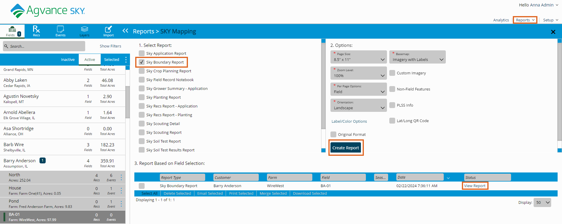
Boundary reports are available to print or download by navigating to Reports at the top right corner of the Mapping window.
- Select the SKY Boundary Report option under Select Report.
- Use the drop-down menus to specify the page setup under Options.
- Choose Create Report. The report will process, and the status will change to View Report when processing is completed.
- Select View Report.
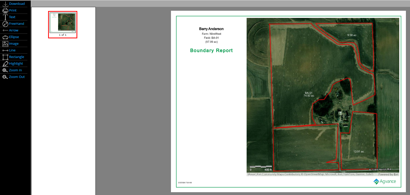
- The SKY Boundary report loads and text or drawing objects can be added. A PDF file of the map can also be printed or downloaded.