This utility at Hub / Setup / Geocode Agvance Data gives the ability to geocode customer addresses, ship to addresses, locations, fields, and tanks. The latitude and longitude may be viewed along with a map.
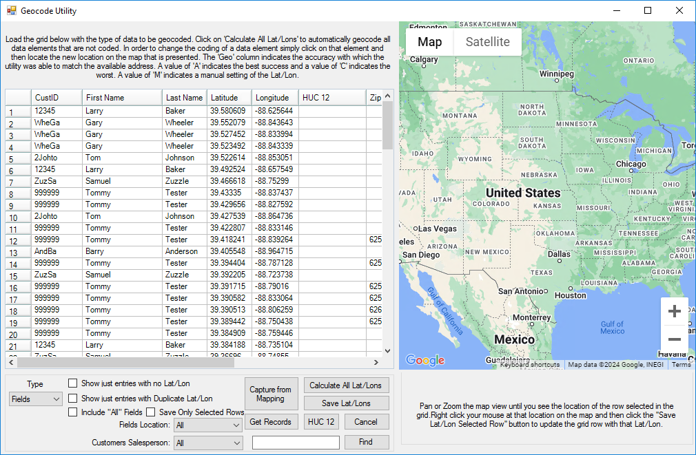
- Type – Select the drop-down to choose from Customers, Ship To’s, Locations, Fields, and Tanks. The selected type determines the information to be geocoded. Depending on the type selected, additional filters are available.
- Layers – This may be used in conjunction with PinPoint, Dashboard, or Ownership data.
- Show just entries with no Lat/Lon – Select this option to display only the entries with no Lat/Lon.
- Show just entries with Duplicate Lat/Lon – Select this option to only display duplicate entries.
- Include “All” Fields – With the Type set to Fields, this option is available. With this option selected, Fields with a Field ID of All are included in the grid.
- Capture from Mapping – Select if Fields are referenced by a map in Agvance Mapping.
- Get Records – Use this button to populate the grid according to the options selected.
- Calculate All Lat/Lons – Calculate the latitude and longitude of the entries in the grid.
- Save Lat/Lons – Save the latitude and longitude of the entries that have been calculated in the grid.
- HUC 12 – This is the hydrologic unit code indicating the sub-watershed region. This option is available when Type is set to Field.
- Find Location – Enter an address and select Find Location for a map of the address.
- Save Lat/Lon to selected row – Use the mouse to move the map to a new location. Right-click to select the new location’s latitude and longitude. Select Save Lat/Lon to store the new information on the selected row.
