Farms, Fields, and Field information, such as maps (if available), acreage, current weather conditions, and Field activity can be viewed from the Fields menu.
Fields
Fields can be searched and filtered using the Search field at the top of the page. Search by Farm name, Field name, or No. of acres to filter results.

Each Farm is listed in bold with associated Fields displayed under the Farm Name.

To display Fields for a specific Farm, filter the results by typing the Farm Name in the Search field at the top of the page.
Selecting a Field displays the Field Details page for that Field:
- Tillage Type – View the Tillage Type or select the Pencil icon to edit.
- Field Splits – This displays each responsible party on the Field along with the percentage of the Field for which they are responsible.
- Crop Information – If applicable, the Crop Year, Crop, and Crop Chemistry display.
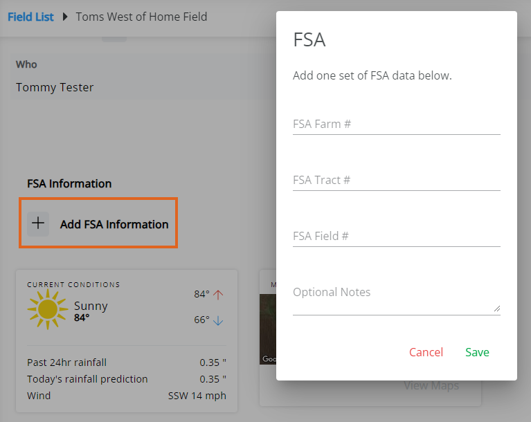
- FSA Information – Select + Add FSA Information to add Farm Service Agency information to that field if needed/available. At least one field must be populated in order to Save.
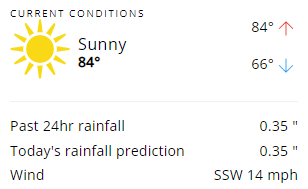
- Current Conditions – This displays the current weather conditions including the high and low temperature for the day, rainfall in the last 24 hours, and wind speed and direction.
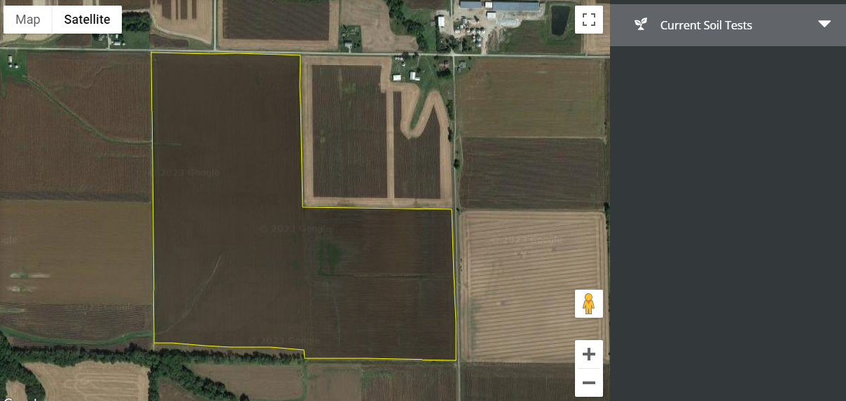
- Maps – This displays a satellite image of the Field based on the current mapped information on record with the retailer. Selecting Explore displays a full-page view of the map for that Field, along with available soil test results for that Field. SKY Mapping Layers (Soil Type, Application Layer, and Yield Layer) display on the field if linked to SKY Mapping. More information regarding setting up SKY Mapping layers in SKY Admin can be found here.
- Plans – Plans marked as Visible in G360 in SKY Customer display under the FSA Information section with the Plan Description and Status. Select View Plans for more information. The Expand button can be selected to view additional details. The option to Reorder Products (if this is turned on in SKY Admin) is available under the Ellipsis. More on reordering Products can be found here.
Note: Plans priced by Analysis display only the analysis and no product information.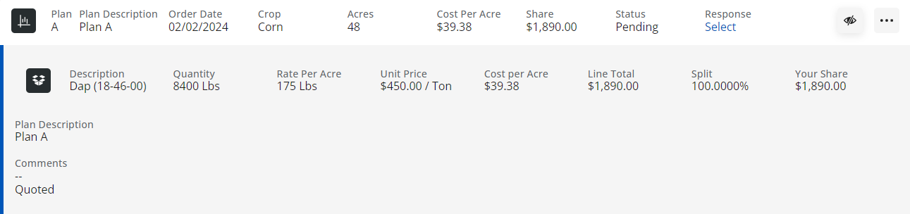
- Activity – This displays all recorded transactions for the selected Field.
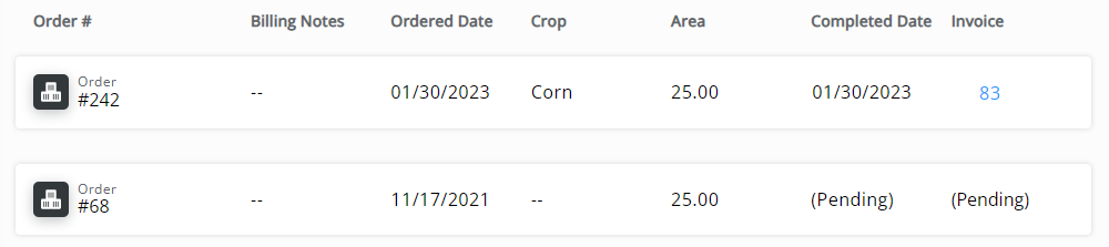
- Order # – This is the number for the Blend Ticket, Field Plan, or Booking on this Field-associated transaction.
- Billing Notes – Any notes associated with the transaction for billing or other purposes display here.
- Ordered Date – This is the date the transaction was recorded.
- Crop – This is the crop associated with the transaction.
- Area Applied – This is the total acreage covered by the transaction.
- Completed Date – This is the date the transaction was completed. This is often the date the product was applied to the field.
- Invoice – This is the Invoice number associated with the transaction.


Field Service Requests
Select Request Service to make a Field Service Request.

This will send a notification to SKY notifications and the Task Center. From SKY, select View Customer to navigate to SKY Customer or Mark Resolved to indicate the Field Service Request has been completed.

Enter Comments when marking as resolved indicating how the request was resolved. These comments can be referenced later from the task list.
The Expand icon can be selected to view more details on the Field Service Request.
