The Hub offers an export utility that creates shapefile boundaries for any existing Field a Customer wants to import into Agvance SKY Mapping. The Export Shapefiles utility can be used to create multiple shapefile boundaries for numerous Customers at a time. When boundaries are exported using this utility, the files are formatted and ready to import into Agvance SKY Mapping.
- Navigate to the API tab at Hub / Setup / Company Preferences.
- Go to the Mapping Interface tab.
- In the Export Shapefiles area, use the Browse button to navigate to the folder where the shapefile boundaries should be exported and select OK. The Export Folder path will populate with the path selected.
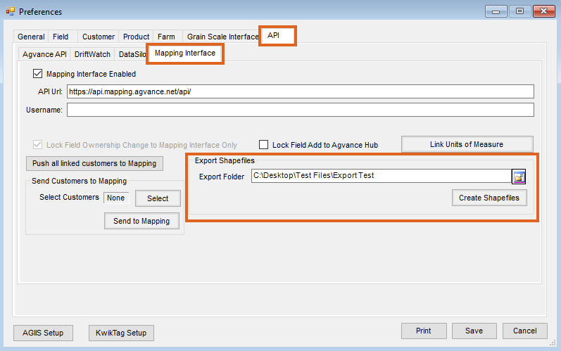
- Select Create Shapefiles. The Select a Field window opens to choose which for Customers shapefile boundaries should be exported.
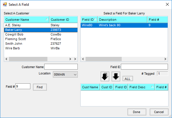
- Select a Customer on the left. Choose one Field at a time with the Single Arrow or all Fields for that Customer by selecting the Multiple Arrow. Add as many Customers/Fields as needed.
- Select Done. The request will be processed and a window will display the number of shapefile boundaries created.
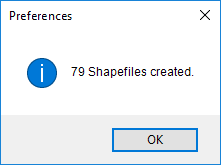
- The file is saved at the Export Folder path selected and can now be imported into Agvance SKY Mapping.
Note: If the Export Folder created was c:\NewExport, the following folders will be created:- c:\NewExport\CustomerID
- c:\NewExport\CustomerID\FarmID (This folder will contain the Field boundary files. The name of the file is the Field ID.)